|
|
 |
 |
|
Favorite
Links |
 |
Add Your
Map Link |  |
|
 |
|

|  |
1 - 14 |
|
|
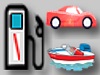
| Fuel Locations Map
NE Oklahoma Fuel for you, your car and for your boat. Gas Docks, Gas Stations, food, drinks, ice and supplies |
|
|
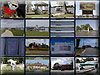
| Fuel Your Boat & Your Car Image Slider
Summer Town Information. Helping you find your summer fun in the sun. :) see a few locations in an image slider ... |
|
|
| AirNav: 3O9 - Grand Lake Regional Airport
Complete aeronautical information about Grand Lake Regional Airport (Afton OK USA) Monkey Island including location runways taxiways navaids radio frequencies FBO information fuel prices sunrise and sunset times aerial photo airport diagram. 918 257-8602 |
|
|
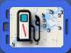
| Mobile Fuel Locations On The Map
Mobile - Find Fuel locations in your Car or on the Lake, with Convenience Stores, Restaurants, and other services. Grand Lake Links, Helping you find your summer fun in the sun. :) |
|
|
| AirNav: KMIO - Miami Municipal Airport
Complete aeronautical information about Miami Municipal Airport Miami, OK, USA, including location, runways, taxiways, navaids, radio frequencies, FBO information, fuel prices, hotel and motel listings, hotels, weather, sunrise and sunset times, aerial photo, airport diagram. |
|
|
| AirNav: H04 - Vinita Municipal Airport
Complete aeronautical information about Vinita Municipal Airport Vinita, OK, USA, including location, runways, taxiways, navaids, radio frequencies, FBO information, fuel prices, hotel and motel listings, hotels, weather, sunrise and sunset times, aerial photo, airport diagram. |
|
|
| AirNav: KGMJ - Grove Municipal Airport
Complete aeronautical information about Grove Municipal Airport Grove, OK, USA, including location, runways, taxiways, navaids, radio frequencies, FBO information, fuel prices, hotel and motel listings, hotels, weather, sunrise and sunset times, aerial photo, airport diagram. |
|
|
| AirNav: 4O6 - Cherokee Seaplane Base
Complete aeronautical information about Cherokee Seaplane Base (Afton, OK, USA), including location, runways, taxiways, navaids, radio frequencies, FBO information, fuel prices, sunrise and sunset times, aerial photo, airport diagram. |
|
|
| AirNav: OK30 - Grandcraft Landing Strip Airport
Complete aeronautical information about Grandcraft Landing Strip Airport (Langley, OK, USA), including location, runways, taxiways, navaids, radio frequencies, FBO information, fuel prices, sunrise and sunset times, aerial photo, airport diagram. |
|
|
| AirNav: OK95 - Disney Airport
Complete aeronautical information about Disney Airport (Disney, OK, USA), including location, runways, taxiways, navaids, radio frequencies, FBO information, fuel prices, sunrise and sunset times, aerial photo, airport diagram. |
|
|
| AirNav: 44OK - Bacon's Heliport
Private use. Permission required prior to landing. Complete aeronautical information about Bacon's Heliport (Disney, OK, USA), including location, runways, taxiways, navaids, radio frequencies, FBO information, fuel prices, sunrise and sunset times, aerial photo, airport diagram. |
|
|
| AirNav: 65OK - Lakemont Shores Heliport
Private use, MEDICAL. Complete aeronautical information about Lakemont Shores Heliport (Disney, OK, USA), including location, runways, taxiways, navaids, radio frequencies, FBO information, fuel prices, sunrise and sunset times, aerial photo, airport diagram. |
|
|
| AirNav: 31OK - Siegfried Point Heliport
Private use. Permission required prior to landing. Complete aeronautical information about Siegfried Point Heliport (Disney, OK, USA), including location, runways, taxiways, navaids, radio frequencies, FBO information, fuel prices, sunrise and sunset times, aerial photo, airport diagram. |
|
|
| Touch N Go
918 257-8602 56351 E Highway 125, Afton, OK |
|
| | | |